
Heavy rains associated with Hurricane Irene have already dropped about seven inches of rain across eastern North Carolina. Rain has stopped in many areas from the Triangle east.
The following forecasts are based on rainfall totals of 4 to 5 inches:
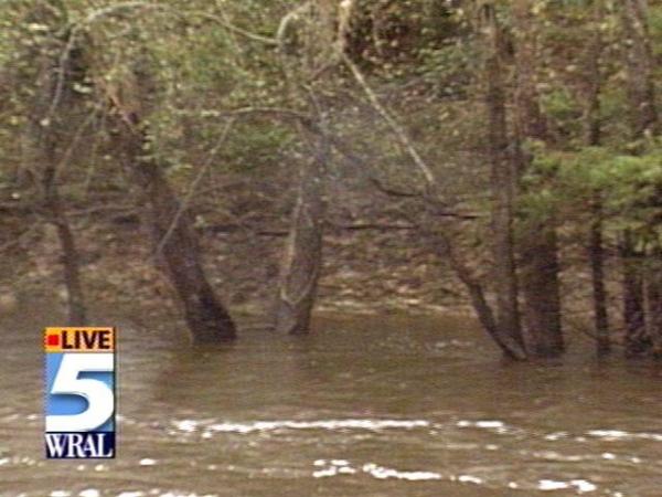
On Sunday morning, the Neuse River at Kinston was 14.9 feet and starting a slow rise. Flood stage is 14 feet. The river is expected to crest around 22 feet on Tuesday, Oct. 26.
A river level of 22 to 23 feet will flood homes and businesses southeast of Kinston. Highway 11 and numerous secondary roads will become impassable. Water will flood the Rivermont area. Evacuations of residents in flood-prone areas southeast of Kinston will be needed. Contentnea Creek will cause widespread flooding of Tick Bite and Grifton. Many streams across Lenoir, southern Pitt and northern Craven Counties will flood secondary roads and homes.
The Sunday morning stage of the Tar River at Greenville was 5.6 feet and starting a slow rise. The flood stage is 13 feet. The river is expected to crest around 20 feet on Saturday, Oct. 23.
This will begin to flood several homes near the river. Areas on the north side of the river will be the most threatened. In the city of Greenville, water will overflow into the town commons and adjacent areas. Many acres of farmland will flood.
On Sunday morning, the Cape Fear River at Chinquapin was 8.3 feet. The flood stage is 13 feet, and is expected to crest around 19 feet by Friday, Oct. 22.
A river level of 19 to 20 feet will cause widespread flooding over much of the county. Many evacuations will be needed along the northeast Cape Fear River and its tributaries. Most roads will become flooded and impassable. Numerous homes and communities near the river will begin to flood.
The Roanoke River at Williamston was 9 feet on Sunday morning. Flood stage is 10 feet. The river is expected to crest around 11.5 feet by Wednesday, Oct. 20. This will cause minor flooding of low lands and some secondary roads adjacent to the river.
Residents along and near these rivers and adjacent tributaries should monitor effects of Irene as they unfold during the next 24 to 48 hours to determine if and how severe the river flooding will be.
These NWS forecasts are based on 4 to 5 inches of rain. If more rain falls over the river basins, river levels will crest higher than forecast.
Meanwhile, a flash flood warning has been issued until 2 a.m. Monday for the following eastern North Carolina counties: Martin, Jones, Duplin, Carteret, Lenoir, Washington, Beaufort, Greene, Craven, Pamlico, Onslow and Pitt.
Additionally, the NWS has issued a flash flood warning until 6:40 p.m. for Cumberland, Hoke, Sampson, Scotland and Wayne Counties. NWS Doppler radar indicates heavy rains moving through the Southeast Piedmont and Sandhills regions.
Bands of heavy rain will continue to move through Fayetteville, Clinton, Seven Springs, Harrells and Salemburg. These heavy rain bands were expected to move through Laurinburg, Raeford, Mount Olive, Goldsboro and Fremont between 2:45 and 4 p.m. Sunday. Rains were expected to total between 2 and 3 inches during this time period, and will create flash flooding in roadways and in low-lying areas.
At 4:30 p.m., the NWS has extended the flash flood watch through this evening for the following North Carolina counties: Bladen, Brunswick, Columbus, New Hanover, Pender and Robeson.
In northeast South Carolina, flash flood warnings have been issued for Darlington, Dillon, Florence, Georgetown, Horry, Marion, Marlboro and Williamsburg.
Heavy rains will continue across the area this evening. Additional rainfall of 1 to 2 inches are possible for inland areas this evening. Locations along the coast may see additional rainfall totals of 2 to 3 inches.
Through 6 p.m. Sunday, areas in Onslow, Jones, Duplin and Craven Counties will be the most likely to experience the first flooding from Hurricane Irene. Other locations can expect flooding later Sunday afternoon and especially Sunday evening and night.
Motorists are advised not to drive their vehicles into areas where the water covers the roadway. The water depth may be too great to allow the vehicle to cross safely. Vehicles caught in rising water should be abandoned quickly.
Shallow, swiftly flowing water can wash a car from a roadway. Also, the roadbed may not be intact under the water. If a vehicle stalls, abandon it immediately and seek higher ground.
Anyone spotting such flooding is asked to report it to the nearest law enforcement agency for relay to the National Weather Service.
• Credits
Copyright 2024 by Capitol Broadcasting Company. All rights reserved. This material may not be published, broadcast, rewritten or redistributed.


 for 2024 season")


