
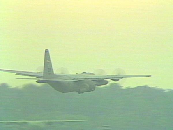
WhenC-130s fly training missions aroundPope Air Force Base, it is not unusual to see them flying just 300 feet above the ground.
They fly low, because in real missions, they use the ground as a reference, and it keeps enemy radar from spotting them.
The crew relies on its own flight maps to identify possible dangers like radio towers and power lines.
"We go to the chart update manual, a chum often called by aviators, to update charts, to ensure everything out there possible that could be an obstruction is adequately portrayed on our charts when we are doing our mission planning," saidAir Forcenavigator Maj. Scott Lockard.
Ashby, aMarinepilot, says his military map was not accurate and did not show the gondola cable he clipped, killing 20 people.
But some Air Force aviators say they have procedures in place to guarantee them the most up-to-date information.
Several hours go into any flight before a crew ever takes to the skies. It's an Air Force standard to ensure safety.
"I would not expect any surprises to pop up that we are not anticipating," said Air Force pilot Maj. Scott Cummings.
Airmen have modern technology to help them, too. AnFAAdatabase on flight restrictions or new obstacles is updated every 28 days.
Of the 15 to 20 C-130 flights a day at Pope Air Force Base, about six of them fly at low altitudes.
• Credits
Copyright 2024 by Capitol Broadcasting Company. All rights reserved. This material may not be published, broadcast, rewritten or redistributed.


