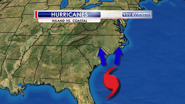
Inland or coastal track, history shows hurricanes' impact on NC
A hurricane's path can mean a world of difference, and just because the Triangle sits a seemingly safe 120 miles up the road from the coast doesn't mean we are immune from a hurricane's impact.
Posted — UpdatedAll hurricanes are unique. No two are the same. They vary in size, intensity and forward speed, and they are also very unpredictable.
Where they move and the path they take can mean a world of difference, and just because the Triangle sits a seemingly safe 120 miles up the road from the coast doesn't mean we are immune from a hurricane’s impact. Case in point: Hurricane Fran!
Now we tend to think we can predict the path and intensities of hurricanes, but computer models can only do so much. Experience and foresight go a long way into understanding what we are up against with an approaching hurricane, but some storms can really throw you a curveball.
Hurricane Fran in 1996 was just that kind of storm. It was a Cape Verde storm that developed off the coast of Africa on Aug. 23. We tracked that storm for 13 days and watched and waited as it closed in on Cape Fear as a Category 3 storm on the night of Sept. 5, a major hurricane with 115mph winds.
The expectation was the storm would make landfall in the Wilmington area and move parallel to the coast and away from central North Carolina. All the model guidance suggested such. Fran instead came right up Interstate 40 into Raleigh.
Granted, it did weaken into a strong tropical storm by the time it reached Raleigh, but it retained gusts of hurricane force. A 74 mph wind gust was recorded at Raleigh-Durham International Airport the morning of Sept. 6.
Thousands of trees were blown down throughout central North Carolina, and over a million people were left without power. Almost two weeks after the storm, 150 secondary roads were still closed due to flooding and downed trees. There were also 14 deaths attributed to Fran in North Carolina, most related to accidents from fallen trees, including trees falling on houses and automobile crashes into fallen trees.
Fran left behind a staggering price tag of roughly $2.4 billion dollars of damage for North Carolina alone! This storm dealt a heavy blow to people who were completely unprepared for an inland storm. Fran was a frightening experience, and one we hope we will never have to live through again. We all learned we must have a hurricane preparedness plan this far inland!
Hurricane Irene, in August of 2011, was an example of a unique storm that followed the forecast path but didn’t really do what we expected.
The storm was born just east of Dominica in the Lesser Antilles and moved through the Virgin Islands, Puerto Rico, the Bahamas and finally off the coast of Morehead City by the morning of Aug. 27. It had the barometric pressure of a Category 3 storm of 951 mb but was classified as a Category 1 storm with top winds of 85 mph. This is one of the oddities of hurricanes as it had a barometric pressure of a storm resembling a major hurricane yet it did not exhibit that. What is even more peculiar is the highest wind recorded by Irene was 67 mph and that was from a buoy near Cape Lookout, well below the forecast intensity.
The path of the hurricane was thought by many to be the worst-case scenario for the Outer Banks – just east over the Pamlico Sound – but the damage was not as extensive as many had worried. It did take Irene over 10 hours to move through North Carolina from its landfall at Cape Lookout and to its exit near Duck. There were reports of tornadoes, flooding and breaches of NC Highway 12.
Inland, the hurricane caused multiple flooded areas and uprooted trees. In Nash County, a snatched tree limb struck and killed one person. Prior to the storm, a resident in Onslow County suffered a fatal heart attack while applying plywood to his house. Two people in Pitt and Sampson Counties were killed by falling trees, and two others in Goldsboro and Pitt County died in storm-releated in traffic accidents. A man also drowned in the flooded Cape Fear River. In all, over 1,100 homes were destroyed. The estimated $71 million in damage did not include agricultural losses.
Now as we get into the heart of this hurricane season with the peak coming in early September, we all need to be prepared no matter if we are at the coast or farther inland in the Triangle.
Those who have moved to North Carolina since 1996 need to especially take note as we are reminded by history of what a hurricane can do to our state, whether it be at the coast or farther inland.
Be safe everyone!
Copyright 2024 by Capitol Broadcasting Company. All rights reserved. This material may not be published, broadcast, rewritten or redistributed.


