After evening of sleet in Triangle, eyes turn to possible Friday snowfall
Parts of Triangle could see anywhere from a trace to an inch of snow accumulate by early Saturday morning.
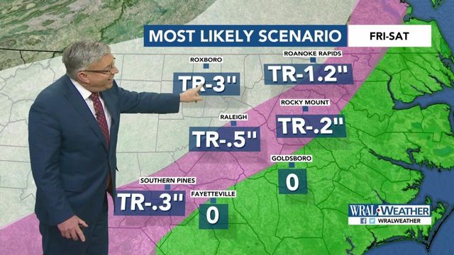
Posted — UpdatedFishel showed a range of possibilities – from a trace to three inches of snow for Roxboro, with lower values for communities in the Triangle and no snow for the Fayetteville or Goldsboro areas.
"Remember though, trace is just as likely as the three," Fishel said, in an effort to calm eager snow lovers looking ahead to the first chance for flakes of the season.
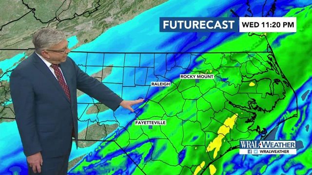
"The only thing we're going to see around here is some very light sprinkles," Fishel said of the rest of the night.
Temperatures will reach the 50-degree mark again Thursday before taking a drastic dip that will allow rain to turn to wintry mix and possibly snow Friday into Saturday.
Friday will start out cold, with temperatures just a touch above the freezing mark, Fishel said. Then the temperature sinks as the chance for precipitation rises into Friday evening.
"We continue to watch a deep, upper-level trough to our west and some possible surface lows that may track north just offshore to our east. Temperatures may be cold enough to allow some of the resulting precipitation to fall in frozen form," Fishel said.
Fishel said the precipitation will likely start out as rain for many before transitioning to wet snow late Friday night through Saturday morning. The chance for accumulation, however, is slim, he said.
"The bottom line is the ground is very warm and the only way to cool the ground off is if the precipitation intensity really picks up," he said. "If you've just got a few flakes randomly dancing around, it's not going to stick. It's got to be coming down like gangbusters."
While temperatures 5,000 feet over Raleigh are likely to reach the freezing mark sooner, a freeze at the surface is more likely to the north and west of the Triangle, Fishel said.
That means a greater chance for snow and a greater chance for accumulation in the usual places, like Roxboro.
A full 48 hours before the anticipated event is still too far out with too many variables to make a firm forecast, Fishel said, but he doubts the forecasted snow would have any large impact on road conditions.
"If I had to pick a worst case scenario for the roads, it would be slush. I don't see any way we get into an icy situation here. It's just too warm," he said.
Even after the skies clear, the cold sticks around into next week, with forecast highs only in the 40s.
Sunday and Monday will offer mostly clear skies, but a true relief from winter's cold is nowhere in the seven-day forecast.
"Looking into the middle of next week, we'll have another strong surge of cold temperatures," WRAL meteorologist Aimee Wilmoth said.
• Credits
Copyright 2024 by Capitol Broadcasting Company. All rights reserved. This material may not be published, broadcast, rewritten or redistributed.


