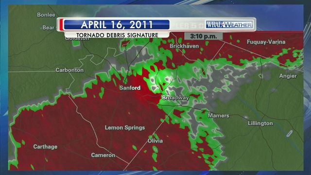
Dual Doppler helped track 2011 tornado
WRAL viewers are used to seeing the Dual Doppler during the weather forecast, but the technology was fairly new when a tornado ripped through the area on April 16, 2011.
Posted — UpdatedThe Dual Doppler can see inside a storm better than other technology and can do so in 3D. The technology also allows meteorologists to see a debris signature when a tornado is in the forecast.
WRAL meteorologist Mike Maze explained that when the tornado came through five years ago, the Dual Doppler allowed him and WRAL meteorologist Nate Johnson to see where there was debris in the atmosphere, which indicated that there was a tornado on the ground.
Maze recalled that the tornado that caused devastation throughout the state, touched down and remained on the ground for 60 to 70 miles at a time and even headed toward downtown Raleigh at one point.
“When we were on the air, we thought the tornado was coming straight for the TV station,” he said.
• Credits
Copyright 2024 by Capitol Broadcasting Company. All rights reserved. This material may not be published, broadcast, rewritten or redistributed.


