Drier air, sunshine on its way to Triangle after Irma dissipates
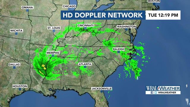
The storm that was once Hurricane Irma fell began to fall apart on Monday, leaving traces of itself scattered across the South and Southeast on Tuesday that drizzled rain around the Triangle.
Posted — UpdatedWRAL meteorologist Elizabeth Gardner said the storm now resembles a large low-pressure system that covers several states. It will continue to produce some rain and winds, Gardner said, but neither will be significant.
"(Irma) was very tightly packed and symmetrical (in the Caribbean), and of course it had that eye, and it was large, but now that it's fallen apart, it's just become this enormous thing that stretches all the way from Louisiana up to Ohio and then back off the coast of North Carolina."
Tuesday will be mostly cloudy and windy with bands of showers, especially morning to midday. Temperatures will be much warmer than Monday, with highs in the mid to upper 70s, and winds that could gust to around 15 to 25 mph early should diminish throughout the day.
Dry air moving up from the south will filter into North Carolina on Tuesday evening, Gardner said, which will bring clear skies and sunshine.
"Not that there won't be a couple little pop-up showers that happen later on this evening, but once we get past sunset, most of this begins to taper off and go away," Gardner said.
Temperatures will rise into the low 80s on Wednesday afternoon with more sunshine across the Triangle, though a slim chance of showers remains. Mid-80 degree temperatures will stick around all week, too, Gardner said.
• Credits
Copyright 2024 by Capitol Broadcasting Company. All rights reserved. This material may not be published, broadcast, rewritten or redistributed.


