Hurricane Joaquin's track shifts farther east
Hurricane Joaquin continued to strengthen in the Atlantic Ocean Thursday afternoon, becoming an extremely dangerous Category 4 storm.
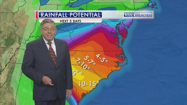
Posted — UpdatedWRAL meteorologist Mike Maze said Joaquin may have a smaller effect on North Carolina as initially expected, but the State will still see heavy amounts of rain throughout the weekend.
“We are seeing improvements, for at least our area. It looks like the heaviest rain total could be in western North Carolina and South Carolina,” Maze said. “It appears Joaquin will never have any effect on North Carolina. The system that is setting up over us would help defect the storm away and keep it in to the Atlantic."
At 4:20 p.m. Thursday, Joaquin was a powerful Category 4 storm with maximum sustained winds of about 130 mph. The storm is centered near the central Bahamas, about 900 miles south-southeast of Raleigh, and it is still drifting west-southwest at about 6 mph.
Joaquin exploded in the last 24 hours, going from a Category 1 storm with winds of about 80 mph to a major hurricane. Its forecast track has been just as volatile.
By the time Joaquin is along the Carolina coast during the day on Sunday, it is expected to be a Category 2 storm.
Officials in Hyde County declared a state of emergency and ordered residents and visitors to evacuate Ocracoke Island. No inbound traffic will be allowed beginning Saturday.
After moving past North Carolina, Joaquin is expected to continue to weaken and as it moves northeast.
Ahead of Joaquin, much of central and eastern North Carolina is expected to see several inches of rain as a cold front combines with an area of low pressure on Thursday, Friday and Saturday. Some spots could see between 5 and 7 inches of rain.
The National Weather Service has issued flash flood watches for the entire area from 8 p.m. Thursday through 8 p.m. Sunday, warning of flooding in low-lying, flood-prone areas. State Emergency Management officials said downed trees could also be an issue.
"We may even see some trees and power lines coming down, especially if we have some wind gusts that knock down trees," spokeswoman Julia Jarema said.
Officials say families living in flood-prone areas should be prepared to evacuate anytime in the next three to four days.
• Credits
Copyright 2024 by Capitol Broadcasting Company. All rights reserved. This material may not be published, broadcast, rewritten or redistributed.


